|
Maintained
and
Existing
NPS Trails

Maintained and existing trails
are from the most recent Acadia National Park GIS data available on
their website.
http://science.nature.nps.gov/nrdata/index.cfm . You can get
the entire trail system in .shp format which you will need to convert
for your gps unit.
Or you can download
NPS2010trails.gpx in GPS eXchange (.gpx)
file format, which can be read and transferred to your GPS.
above file was downloaded from nps site and converted
7/15/2010
Some helpful NPS coordinates can be
found here
http://www.nps.gov/acad/planyourvisit/gpscoordinates.htm
Not all GPS map programs are created
equal. Since all data contained on this site was constructed using
EXPERTgps it will present itself best using EXPERTgps. A free 30day
trial is available at
http://www.expertgps.com/ . EXPERTgps currently supports
Garmin, Magellan, and Lowrance GPS units.
Other programs Mapsource, Topo etc
will open the files but in many cases you will get sequential numbered
tracks vs track names. I am currently reworking all data which
will resolve this.

NPS
Safety Suggestions
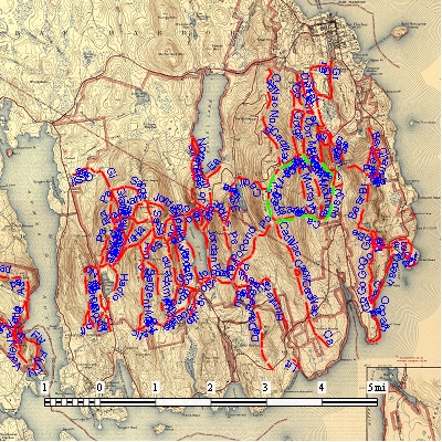
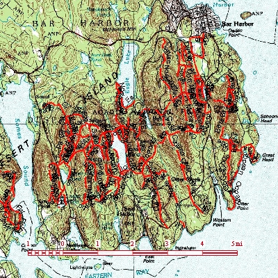
The Acadia trail system contains
about 120 miles of trails
broken down into approx 450 track segments
Alphabetical Trail Listing
Name, surface, length Feet, Length Mile and Trail number
|