|
Gps
Acadia |
 |
Gps
Acadia |
|
Discovering and Mapping
the lost trails and history
Acadia National Park
Mount Desert Island
Welcome. This site
contains gps data collected in
the field using using historic
trail maps, guides and
years of hiking in Acadia National Park |
|
|
| |
|
|
|
1942 Topo Map with GPS
overlays
|
| |
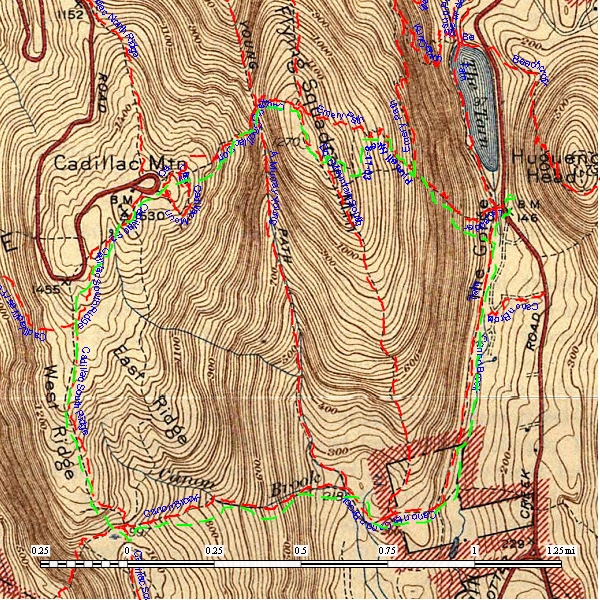
| Scanned 1942 map showing trails and details of Cadillac Mtn. Summit Scanned 1942 map showing trails and details of Cadillac Mountain
Summit showing NPS GPS Overlay of current maintained trails
in Red. GPS mapped hike done by my son in 2003 with an older Garmin GPS unit in
Green. My son Chris has been
hiking the trails since he was 4 and is still known to get off the
beaten path.
|
 |
| Current Topo map showing trails and details of Cadillac Mountain
Summit showing NPS GPS Overlay of current maintained trails
in Red GPS mapped hike done by my son in 2003 with an older Garmin GPS unit in
Green. My son Chris has been
hiking the trails since he was 4 and is still known to get off the
beaten path. |
|
| |
Trails tracks and waypoints
Updated
July 15, 2010
Prepared and Maintained
Les H.
info@gpsacadia.com
copyright 1994-2010 |
|
This site is not associated with the United
States Government,
the Department of the Interior or the National Park Service.
|