|

Data obtained from
http://www.ngs.noaa.gov/cgi-bin/datasheet.prl
For condition and status please refer to
individual data sheets available at the above website.
The Triangulation data contained in the downloadable file is from the
NGS website.
I have verified that all modern Mountain summit stations were in
place as of June 2006. In addition to the summits Great Head
PE1783, and Bass Harbor PE1836 are in place.
If you do not want to read further
download link is at the bottom of the page
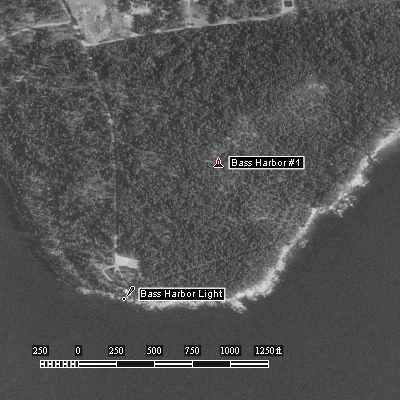
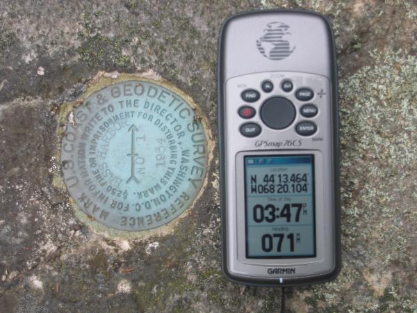
PE1836 Bass Harbor
This marker was reported lost by the Power Squadron in
2005 See NGS Data Sheet
last entry.
After reviewing the sheet I noticed that my submission
of 2004 was missing and that the squadron was actually about 0.21 miles
SSW of the actual marker down by the light house looking over the
antenna enclosure. Aerial photo shows actual location of PE1836 and the
lighthouse where squadron was looking.

Aerial Photo from EXPERTgps showing
Bass Harbor Light and Bass Harbor #1
There was evidence of
Phantom Trails about.
Phantom Trail: a non authorized trail
maintained by person or persons unknown within the park
boundaries.
|
 |
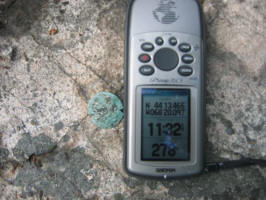 |
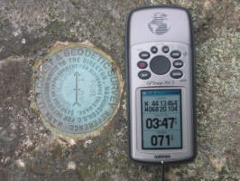
PE1787 CADILLAC GROUND
1968
It is Possible that the Parks
Department paved over, replaced, or removed PE1787
during sidewalk work on Cadillac since June. See recent geocache post
for PE 1787 .
The pictures below show 2 different markers that were within feet of
each other back in 2004 on the approach to the summit of Cadillac as per
the NGS Data Sheet1787.
The data sheet refers to the one on the right but I have often wondered.
Download file
Triangulation Stations
Bench Marks to be Found on MDI
For a quick island Benchmark review click on
links below to some of the benchmarks
I logged back in 2004
Download zipped file
Triangulation.gpx
|