|
Eagle
Lake
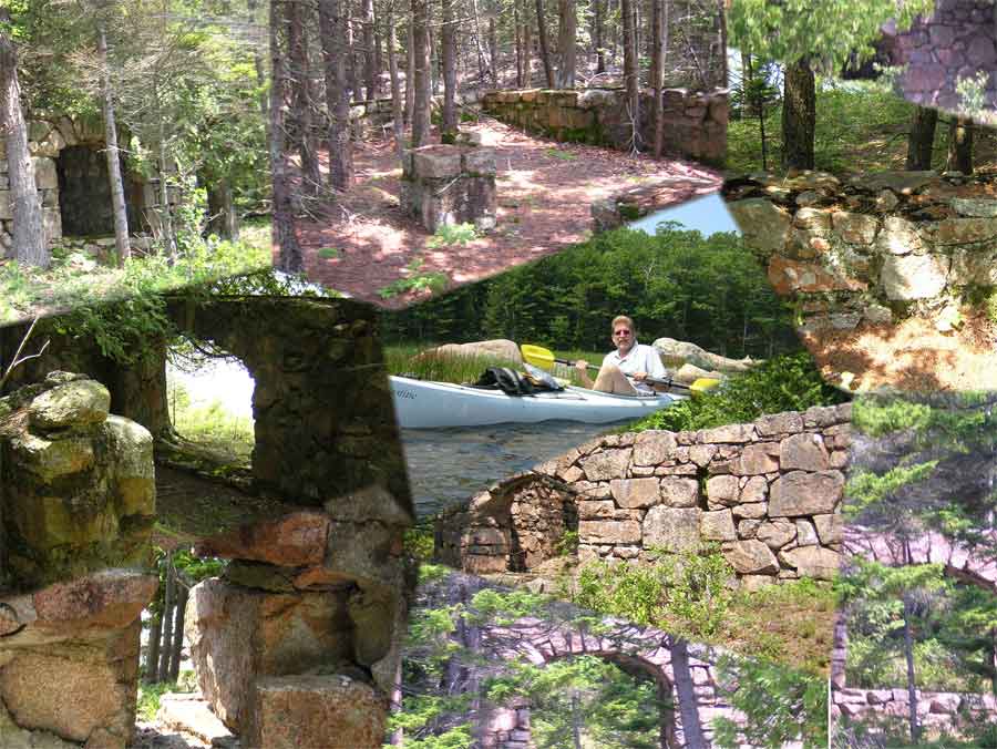
1800's House Foundation
This is a foundation of a Home that was started and never
completed in the 1800's. The Bar Harbor Water
Authority stopped its construction due to concerns of water pollution and visual
impact on the
scenery.
to view individual pictures click
here
I know: f7 it is sideways
Approach to 1800's House Foundation from the water
This is a wonderful kayak adventure. The parking lots on the north
end of Eagle Lake are very popular for hikers, bikers and kayakers and
are frequently full. You may want to drop off your kayak first and
then hunt down a parking space. This is a public water supply so
please follow all posted rules and regulations NO Swimming etc.
Weather and strong winds can be a factor here and can make for an
unpleasant experience. I would suggest paddling the shore line and
enjoying the ride and the views.
The foundation is located
44.21.793 North 68.14.769 West
DMM World Geodetic System 1984
or
44.36322 North 68.24615 West
DD World Geodetic System 1984
|